
ICYMI: Satellite imagery reveals damage to Iran nuclear sitespublished at 09:42 British Summer Time
Paul Brown and Shayan Sardarizadeh
BBC Verify senior journalists
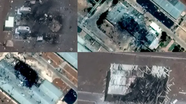 Image source, Maxar / BBC
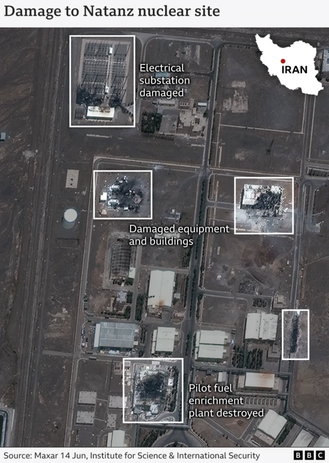
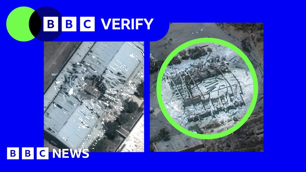
Recently released satellite imagery from Maxar shows the clearest picture yet of what happened at the Iranian nuclear sites at Natanz and Isfahan.
At Natanz, we can see damage to the pilot fuel enrichment plant and an electrical substation, according to analysis by the Institute for Space and International Security.
This follows on from earlier analysis of radar imagery that first showed the damage.
On Friday, the head of the International Atomic Energy Agency, Rafael Grossi, told the UN Security Council that "the above-ground part of the pilot fuel enrichment plant, where Iran was producing uranium enriched up to 60% U-235, has been destroyed".
Uranium-235 is essential both for nuclear power stations and also for nuclear weapons.
Verified footage taken shortly after the strikes show several plumes of smoke rising from the site.
On Saturday, the IAEA confirmed that four "critical buildings" had been damaged in Isfahan,, external including the Uranium conversion facility and the fuel plate fabrication plant.
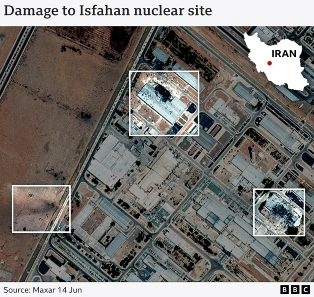
BBC Verify analysis of the latest images from Maxar found visible damage to at least two structures at Isfahan and an apparent scorch mark near the periphery of the site.
The IAEA has said that "no increase in off-site radiation" has been recorded at either Natanz or Isfahan.
- Strikes by Israel and Iran are continuing as the conflict between the two countries enters its fourth day - you can read more about the ongoing conflict in our other live page


 English (US) ·