
How is climate change impacting summer temperatures and when will the heat and humidity finally ease up? Meteorologist John Burchfield has the answers.
TOLEDO, Ohio — When you think of the "dog days of summer," July weather may come to mind. Statistically, July is the hottest month of the year for northwest Ohio and southeast Michigan.
This July has been no exception, dosing out frequent 90 degree days and tropical humidity. The WTOL 11 weather team expects the hot and humid stretch of weather to continue through the final weeks of the month.
How is climate change impacting summer temperatures and when will the heat and humidity finally ease up? Meteorologist John Burchfield has the answers in this week's Climate Friday Newsletter.
The hottest stretch of summer in Toledo occurs from July 4 to July 22 when the average high temperature maxes out at 87 degrees. This peak of summer heat is about 2 degrees hotter than it was just a decade ago based on new climate data from the National Oceanic and Atmospheric Association (NOAA).
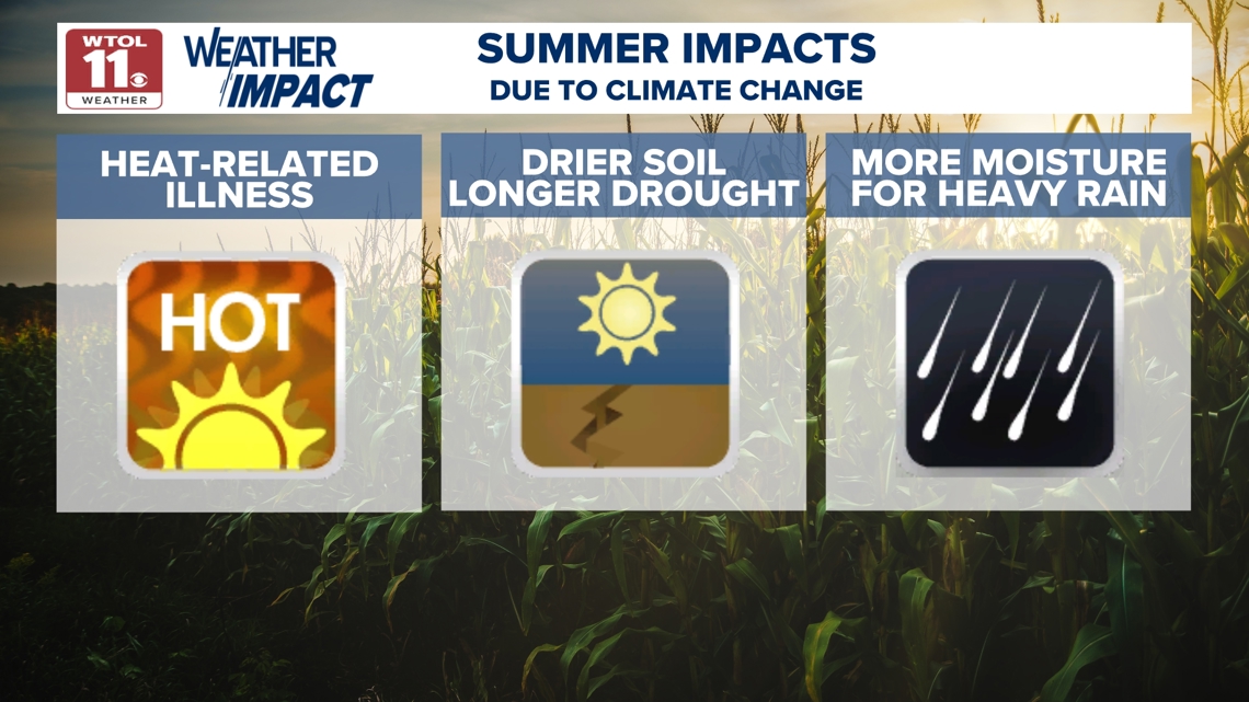
Looking back on changes over the past half century, summers in Toledo have warmed up by 4 degrees since 1970. This summer warming trend is causing tangible impacts, increasing the risk of heat-related illness, producing drier soil and longer drought, and enhancing the amount of moisture available for heavy rain and flooding.


So just how much has climate change impacted each month? In the past decade, June has warmed by 2.1 degrees, July by 1.9 degrees, and August by 2.0 degrees. The magnitude of warming in the early autumn is even greater than over the summer.

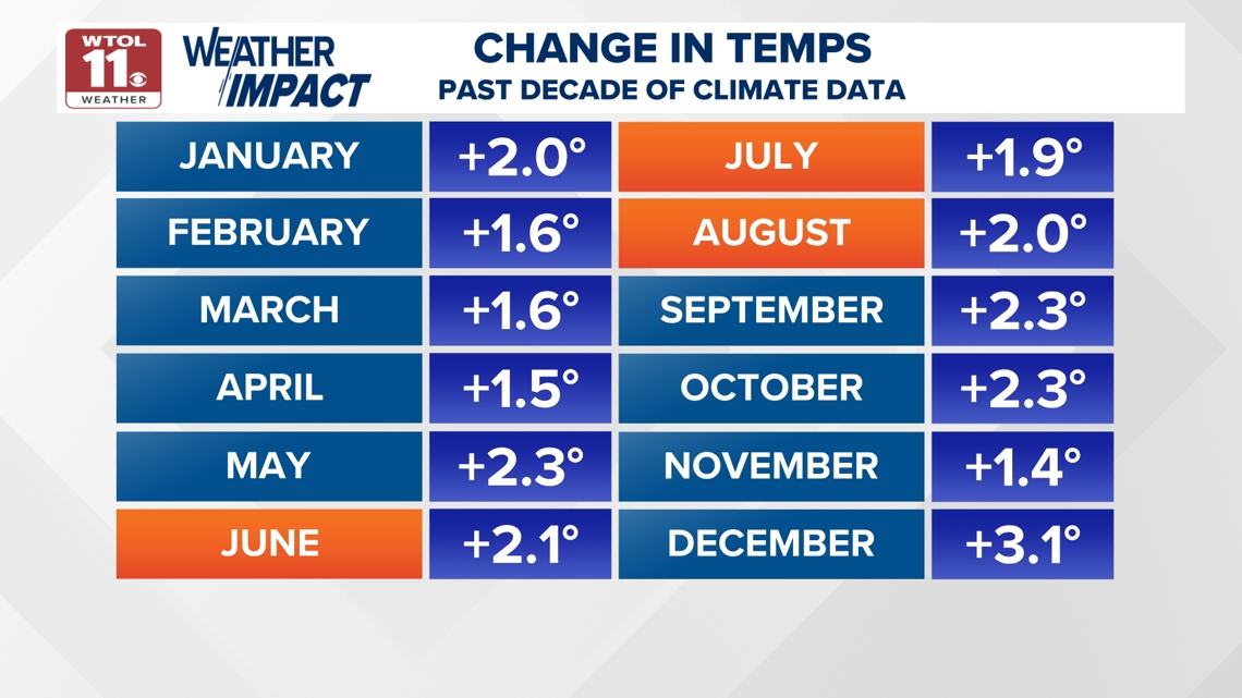
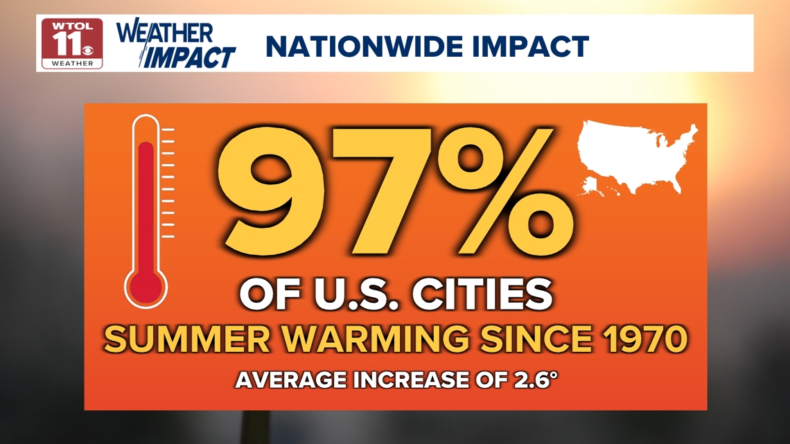
This graphic shows that every single month has warmed up by over a degree in the past decade. This is a trend that has been ubiquitous across the nation. In fact- data from Climate Central shows that 97% of US cities have experienced summer warming since 1970 with a national average increase of 2.6 degrees.

So locally, just how hot has this summer been? This July has already produced six 90 degrees days and we still have two weeks left to add to this tally. Last July brought only two days in the 90s. June temperatures were hot both this year and last year. Both June 2025 and June 2024 brought eight days in the 90s. Each year also brought a seven day consecutive stretch of days in the 90s.
As a whole, this summer has started off significantly warmer than average. June was officially 1.2 degrees warmer than average. July has been 1.6 degrees above average. and the long-range trend points toward hotter conditions through the end of the month.

For those looking forward to some cooler and less humid conditions, the weather changes quickly this time of year and temperatures drop significantly during the final month of summer. While our current average high is still at 87 degrees, it will drop down to 84 degrees in just one month by August 18. The average high in September falls to 78 degrees, October to 65 degrees, and November to 51 degrees.
What about overnight lows? July also brings the warmest nights with an average of 64 degrees. Lows have been even warmer than average this year with many nights in the 70s. The average low drops to 63 degrees in August, 55 degrees in September, 44 degrees in October, and 35 degrees in November. Cooler and less humid days are right around the corner with summer halfway in the books.


Even though we are still in a stretch that may be considered the "dog days of summer", relief from the heat is in sight and it will be here before you know it. Even with cooler days in sight, it's important to note the tangible impacts climate change is having on summertime weather.
Subscribe to the Climate Friday Newsletter for more weekly content on climate change and how it is affecting our weather locally!


 English (US) ·