
Lidar is a high-tech mapping tool used by robotaxis. Now it’s helping homeowners plan for weather disasters.
Sign up for the Slatest to get the most insightful analysis, criticism, and advice out there, delivered to your inbox daily.
Chris Heinrich will never forget the winter day he and his family evacuated their home in Altadena, California, as a vertical wall of flame was slowly bearing down on their neighborhood from the mountains. “It was dark,” he told Slate. “There was no internet, my daughter was crying, the wind was blowing.”
Even as the fires approached, he said, he didn’t really believe that their house would burn. This was, after all, Los Angeles County—the fire department was well prepared, and a network of concrete roads separated the dry, flammable forests from most of the residential areas. But the next day, he got a text from a neighbor: “It’s all gone.”
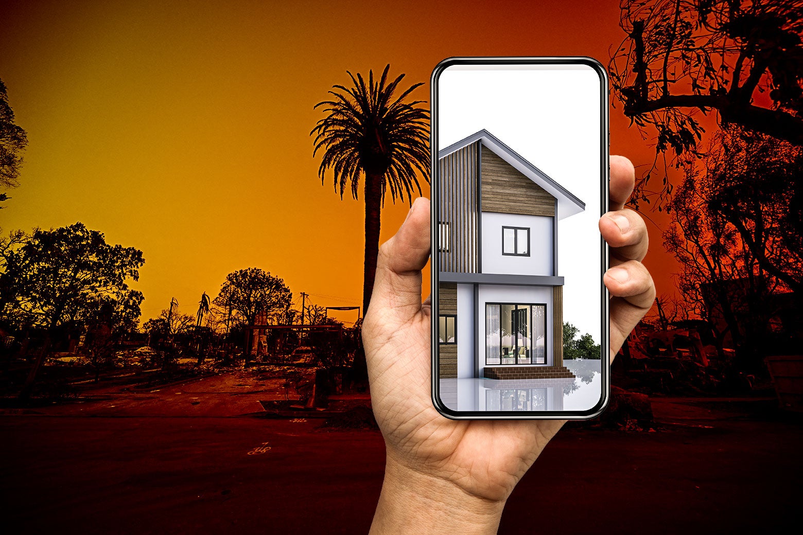
Heinrich’s home was one of more than 18,000 structures destroyed in January’s devastating L.A. wildfires. Unlike many houses in the state, however, it wasn’t completely erased—at least not physically: A painstakingly rendered 3D version survived on Heinrich’s laptop.
Heinrich, a physicist turned entrepreneur, is the CEO and co-founder of tech company Polycam, which makes an app that transforms smartphone cameras into 3D lidar (short for light detection and ranging) scanners. Essentially, lidar works like radar, except it bounces beams of light instead of radio waves off surfaces to generate a 3D picture. In the weeks leading up to the fires, Heinrich said, he had been testing a suite of new features for the app, making his house “probably the most 3D-scanned home on Earth.” Now those scans have become invaluable proof for his family’s insurance claim.
A handful of other homeowners across L.A. have been able to refer to similar 3D reconstructions for insurance purposes; some even plan to repurpose their scans as blueprints to rebuild their houses. As climate change continues to exacerbate disasters like wildfires, hurricanes, and tornadoes, such technology may soon become the best way for homeowners to document their lives and possessions. Scientists and archivists have even begun applying the tech to digitally preserve historic sites vulnerable to extreme weather. Although the tech is typically used by civil engineers for mapping, and by autonomous vehicles such as Tesla’s robotaxis, it may just be one of the most useful tools to emerge during the age of climate disaster.
Stephanie Lin is the vice president of Matterport, a California-based company specializing in 3D-capture cameras. Though Matterport’s lidar technology was originally developed to help real estate agents give virtual property tours, over the years it has also proved indispensable for homeowners faced with climate catastrophe. “Communities were not built with this kind of extreme weather in mind,” Lin told me. “This gives you forensic backup.”
Lidar has been around since the 1960s. It was originally deployed by the National Center for Atmospheric Research to track and measure clouds for more-accurate weather predictions. NASA’s Apollo mission even used it to map regions of the moon. But those early systems were large, expensive, and cumbersome. Even into the 2000s, lidar cameras remained prohibitively pricey for the average person.
Then companies like Polycam, Matterport, and their competitor Docusketch enabled cameras or smartphones—a technology that most people already have on hand—to act as lidar scanners. Most smartphone cameras released in the past five years are equipped with tiny lasers to improve functions like autofocus, and lidar-scanning apps simply repurpose these existing features. That’s a huge time-saver for insurance agents or restoration specialists looking to appraise a property.
David Ma, of Rainbow Restoration in Alberta, Canada, has been using phone-based lidar to scan damaged structures for a couple of years. He told me he previously had to do that work by hand, taking photos and copious notes. “That could all potentially take four or five hours,” Ma said. Now “we’re able to scan an entire home in probably 20 minutes.”
In addition to saving time, digital preservation is becoming increasingly relevant in a world plagued by climate catastrophe. This extends beyond our homes and personal possessions. “We live in a future that is changing radically because of anthropogenic climate change,” Eira Tansey, an archivist and founder of archival services consultancy Memory Rising, told Slate. “That sort of demands that archivists rethink some of our long-held practices.”
Much of Tansey’s work involves digitizing documents from physical structures, such as property records, floor plans, and blueprints. These papers are important from a historical perspective—but they’re also critical for things like home insurance.
When Hurricane Sandy slammed into the East Coast in 2012, it caused billions of dollars in property damage and all but wiped some small towns off the map. Among them was the township of Brick, New Jersey. Brick’s local government had begun investing in a digital archive system six years prior to scan and digitize physical documents. In the wake of the storm, the township was able to present these digital records to the Federal Emergency Management Agency, as well as to state disaster management, insurance adjusters, and engineering firms, to obtain over $14 million in recovery funds. Cases like this, Tansey says, highlight the need for detailed virtual records.
Lidar scans can add an extra layer of information to these existing documents. While digitized floor plans can give a sense of a structure’s size and layout, interior scans actually generate a picture of what the inside of a building looked like, down to the furniture, the appliances, and the art on the walls.
That aspect was essential for Ethan Goldspier, a Polycam employee whose home in the Palisades also burned down in the L.A. fires. Goldspier’s insurance company required proof of lost personal property in order to reimburse his family for it—an expensive couch, for example, or fancy appliances. Having 3D scans that captured the full inventory of each room enormously expedited what could have been a long, drawn-out process. “If you have a digital representation, there’s no argument,” he told me. “The proof is right there.”
This aspect of lidar scanning makes it appealing to researchers documenting delicate archaeological sites. Matterport, for example, has been used to examine the interior of several Egyptian pyramids. Andrew Law, a sociologist at Newcastle University in the U.K., has used lidar mapping to digitally preserve structures along China’s Yangtze River that were threatened or wiped out by extensive damming. “It offers us a chance to conserve things that were already destroyed,” he said.
Of course, technologies like Matterport and Polycam aren’t perfect. Users have to make sure their scans are in focus and thorough enough to paint a clear representation of their home. And simply having a 3D digital replica of a structure doesn’t mean you can bring it back. The ground on which it stood might be too damaged or waterlogged to rebuild, and the prospect of future disasters may deter insurance companies from providing coverage again.
This is becoming a problem in California. Six months before the L.A. fires, Heinrich’s previous insurance company dropped his family’s fire policy. Fortunately, he found comprehensive new coverage after a few weeks, but thousands of other Californians have not been so lucky.
There is a cost trade-off as well. While Matterport’s basic kit starts at $149, its most expensive bundle is upward of $9,000. Polycam is free to download, but the phone app offers a somewhat less detailed virtual re-creation compared with a dedicated 3D-capture camera.
For Heinrich and Goldspier, peering inside the digital ghost of their homes has been a bittersweet experience. Both are glad the records exist. They’ve made the insurance claim infinitely easier, and Goldspier eventually plans to use them as a blueprint to help rebuild. But the process has taken an emotional toll.
“This is like the death of a house … you can’t replace the memories you had there,” Heinrich said. “It’s hard and sad to see.”
Sign up for Slate's evening newsletter.


 English (US) ·